


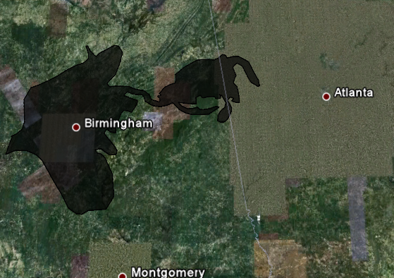
 That’s the question that the folks at Google decided to help people figure out. The image to your left is a screen capture from Paul Rademacher’s website and shows the spill in relation to the size of Birmingham and Central Alabama.
Rademacher’s site currently contains a Google Earth embed using the application’s API that lets you see how the oil spill compares to several major U.S. cities. Here’s a link to a screen capture of the oil spill in relation to Chicago, IL and Lake Michigan. He’s the engineering manager for Google Maps’ front end.
Visiting the site will also let you compare the size of the Deepwater oil spill to any city and points you to where you can download the data to show it in your own install of Google Earth.
UPDATE: Additional images – one showing the spill area in relation to Atlanta and Montgomery and another one showing the capture from when you first enter Birmingham, AL into the interface.
Image: Screen capture from http://paulrademacher.com/

