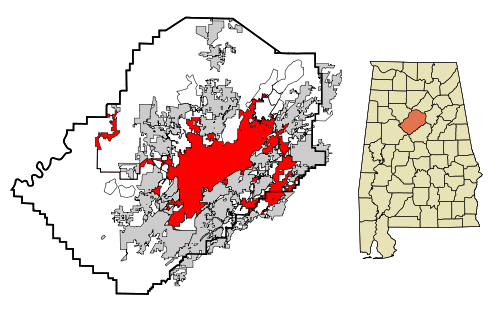
 Earlier this week I shared via my personal social media accounts that it’d been fifteen years since my first visit to Birmingham, AL. Friends posed questions asking me if I’d noticed any changes, leading me to think about what had in that time span.
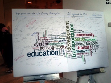
The more I did, the more I looked at the ability to point to specific accomplishments. I also thought about the issues still facing the metro region as the city begins the march towards its 150th birthday in 2021. Then I remembered a conversation I had during that 1998 visit about a yard sign I’d noticed about something called MAPS.
See, my visit to Birmingham for the tenth anniversary of City Stages in 1998 coincided with the beginning of a massive media blitz associated with the public referendum vote on the Metropolitan Area Projects Strategy legislation held on August 4 of that year. I’d try to explain it here, but the link provides a good summary of its goals. The vote was held, the initiative was defeated (except in, incidentally, the city of Birmingham), and life went on as always. Or did it?
When you start to look at the individual components of MAPS and the reasons we’ve been seeing all of this positive press, you begin to realize that time can be a valuable ally for those willing to wait, even for those who still have “The Future Can’t Wait” signs (perhaps playing off the title of a book birthed out of 1963 Birmingham). You also begin to realize just how much of our positive press can be attributed to those projects and what they encouraged.
There are some on a list maintained on BhamWiki of some of those projects listed in order of popularity based on a 1998 poll that seem to be a big reason for our recent success.
The McWane Science Center opened to the public just before the MAPS vote, meaning it was probably held up as an example of what the possibilities were for the region if the plan was approved. The major restoration of Vulcan and his home atop Red Mountain between 1999 and 2004 led to recognition by the National Trust for Historic Preservation in the form of a 2006 Preservation Honor Award.
The Birmingham Zoo did see its expansion, adding the Trails of Africa nearly 40 years after the development of a master plan that had suggested such a change. Ruffner Mountain learned this week it is included in the city council’s version of the 2014 budget as more trails are added to its more than 1,000 acres. Railroad Park anchors an emerging spine of a greenway through the heart of greater downtown. We just reported this week about the upcoming addition of the largest dog park in the city at Red Mountain Park in the city’s western area. The Red Rock Ridge and Valley Trail System hopes to tie it all together and already sees shovels in the ground.
The regional transportation hub is now called an intermodal terminal and it’s set to begin its rise next to the tracks along Morris Avenue late this year while just yesterday both this site and AL.com reported on the first major change to the law governing the BJCTA in more than 40 years. They also unveiled new buses on Thursday.
The Alabama Theatre underwent a restoration in 1998 and the community leaders are working feverishly to raise funds to finally begin restoration of the Lyric Theatre across the street. While it may not be ready in time for its 100th anniversary next year, the sight of construction crews working within will be a welcome one for those working across the street to renovate the former home of Booker T. Washington Insurance Co. into residential units.
The swimming and aquatic center got to see a track and field component added to it, resulting in the Birmingham CrossPlex in Five Points West. This is the same facility that landed the city the NCAA Division II diving, swimming, track and field, and wrestling championships this spring. Uptown is the realization of the first phase of the expanded convention center complex and entertainment district (though as Kyle Whitmire reported Thursday for AL.com, currently proposed changes to I-20/59 threaten those plans).
The 1% sales tax increase? It’s been implemented in piecemeal throughout the region in recent years (most notably – and controversially – via former mayor Larry Langford’s Birmingham Economic and Community Revitalization Ordinance in 2007, itself a mini-version of MAPS) as the need for the funding source has been realized. It is not the best approach towards raising the capital, but perhaps recent developments like the availability of a state historic tax credit for residential projects will help us see historic homes restored and occupied, leading to more property taxes being collected from a large population.
Yes, we have lost businesses and things haven’t always gone the city’s way. There is still much to be done in our outlying neighborhoods and our city center, but there are signs of progress that don’t necessarily involve waiting for elected officials to lead the way. Parking meters don’t work, sidewalks don’t exist, and lights are not always glowing at night. They must be dealt with, and soon. However, if we only dwell on those things, we’ll miss out on what has happened. Community gardens serving food deserts, signs of reinvestment in neighborhoods some wrote off. There are signs of belief in the future of the city – something I didn’t necessarily see on display in large amounts during that first visit or when I first relocated nine years ago.
Actual maps are a funny thing. They can tell you where you need to go, but they won’t always tell you about obstacles (or websites) in the way.
Most Sundays I write down the word “patience” on a prayer request card at church because I think I don’t have enough. I’d argue sometimes we don’t know what we have until it sneaks up on us – like an All-America City that still has issues to tackle, but one that’s come a long way from where it thought it would be fifteen years ago.
Just imagine if MAPS had passed? Scary, isn’t it? But we’ve still got a road map to follow, so let’s get to it. That is what’s changed – the increase in the belief in the perpetual promise of the city and the region.
André Natta is the stationmaster for bhamterminal.com.


 There is sure to be a rather large crowd sitting in


 Within moments of UAT winning its most recent BCS Championship,
  It’s been awhile since I’ve written about former Birmingham mayor
 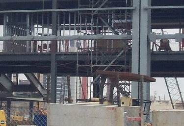 Yes, this is a photo of construction at


More things to think about regardless of the I-20/59 conclusion
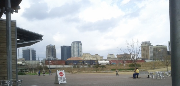
Now, I drive by the BJCC and Uptown every day. As a result, I’ve had several other questions on my mind in recent weeks as it relates to I-20/59 and ALDOT’s proposed changes. I’m sure someone’s going to get to these at some point, but I wanted to go ahead and get these thoughts out there too just to see what bubbles up from readers:
Where do the cars currently parking under the interstate go? A lot of cars will be looking for new places to park as a result of the currently proposed configuration and the closing of 9th Ave. N. A survey of spaces located between 18th and 23rd Sts. N. underneath the interstate and along 9th suggests at least 625 (and as many as 660) vehicles will need to figure out where to go (special thanks to the RPCGB for helping to gather this info so quickly) once this project begins to move forward. This, provided new development continues to occur adjacent to the BJCC begs a follow-up question:
Where do we build a new parking lot (or do we even need to build a new one)? Before we jump on the “we need to build a new deck” bandwagon, it may help to pause and look at the bigger picture. This may be the spark needed to implement an expanded shuttle service downtown. It may even encourage folks to use the existing service provided by the BJCTA. The idea of enabling commuters and visitors to park in one of the lots located along Morris Avenue or any of the existing parking decks maintained by the Birmingham Parking Authority is intriguing. On-street parking options are plentiful, but not sufficient for those visiting the museum or the BJCC and unable to check their meters continuously throughout the day. A shuttle only works is if you can get folks out of their current need of having to park as close to their location as possible. It’s something possible to accomplish if you made it a more logical (read – cheaper) option to park in the decks than on the streets (the way many cities approach managing their parking situations to free up on-street spaces for shorter visits to stores).
Is it time for directional signage citywide? We seem to like tackling the creation of gateways for the city; the recent tree planting at the 31st St. N. exit suggests the corporate community is willing to help the city put its best foot forward as we see increased visitors not just this year, but arguably over the next five as we continue to commemorate milestones in the civil rights movement. Wayfinding, however, has been an issue the powers that be have been discussing for a long time. The Medical District is the most recent section of Birmingham to attempt to tackle it. Individual sites and attractions have tried as well as they tire of waiting for a comprehensive solution to surface.
If we accept that the ramps will go away regardless of what happens, we can also admit it will provide an excuse for visitors and locals alike to explore not just greater downtown, but the entire city (if only because it’s now a possible “accident” waiting to happen). It’s a chance to make sure all are aware of the options and experiences available to them. It could also make it easier for folks to navigate an already insane grid system.
Speaking of the grid…
Is it time to wave “bye-bye!” to the one-way streets downtown? One of the reasons often given for the existence of one-way streets in Birmingham’s city center is because of the ability to get into and out of downtown as quickly as possible via the surrounding highways. The elimination of the ramps providing access to these thoroughfares could be the impetus to finally carry out a major recommendation of the 2004 City Center Master Plan – converting many one-way streets back to two-way. It’d probably be most helpful along those streets most affected by the proposed interstate changes – thoroughfares like 5th Ave. N., 18th St., 22nd St. and Richard Arrington, Jr. Blvd. As many hope to see more restaurants and stores move downtown to serve the estimated 80,000+ that venture in every day, it sure would be nice to make them more visible from multiple directions. It could even encourage more foot traffic – thanks to increased “eyes on the road” for peace of mind.
These are questions not necessarily considered when looking at the situation on its surface, but they will be ones where answers are more critical to the period of during and after construction of whatever happens. Ironically, the very thing the proposal aims to get to pass through the city quickly – the car – is the one thing that will lead to significant decisions to be made about how downtown will continue to adapt and change as it enjoys a national and international close-up.
7 Comments
Posted in Commentary, development
Tagged ALDOT, Birmingham, I-20/59, parking